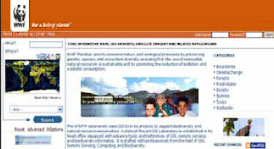
 www.wwfgeonetwork.org www.wwfgeonetwork.org
is an Open Source catalog application to manage spatially referenced data of WWF – Pakistan. It provides powerful metadata editing and search functions to publish and access thematic maps available under the categories specie, forest, climate change, Toxics, Freshwater and boundaries. |
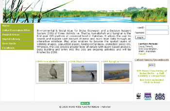 www.dss-foreverindus.org www.dss-foreverindus.org
is an online interactive Environmental & Social Atlas for Indus Ecoregion for three districts i.e. Thatha, Nawabshah and Sanghar. The application allows the user to search and explore vast amount of meso and micro level data through an interactive interface.
|
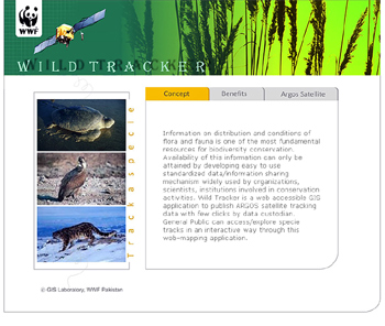 www.wildtracker.pk www.wildtracker.pk
is a web accessible GIS application to publish ARGOS satellite tracking data with few clicks of the buttons by the data custodian. General Public can access/explore species tracks in an interactive way through this web-mapping application. |