GIS Laboratory
National level species distribution mapping
Habitat mapping of key fauna species
Baseline information compilation and change analysis of natural resources
Building capacity in Conservation GIS
Web Applications of GIS Laboratory
Publication List
Boundary Delineation and Renotification of Protected areas
Boundary Delineation of State Forests - Murree Forest Division
Atlas of Legal Boundaries of Murree State Forest
Home :
GIS
:
Boundary Delineation of State Forests - Murree Forest Division
Comparison of Temporal Satellite Images from Google Earth of Murree Forest
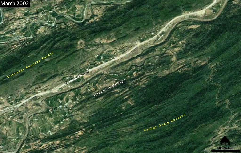
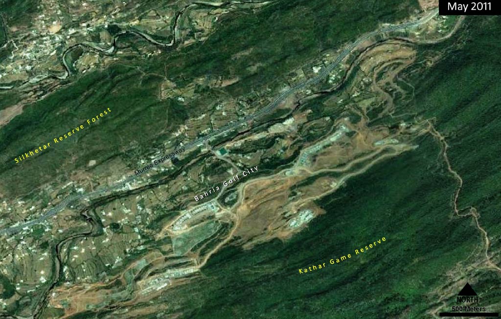
Construction - Kathar Reserve Forest
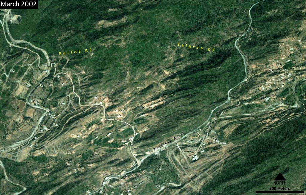
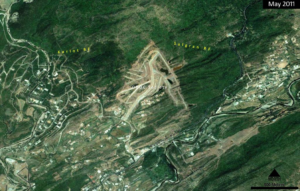
Construction - Salgran and Karlot Reserve Forest
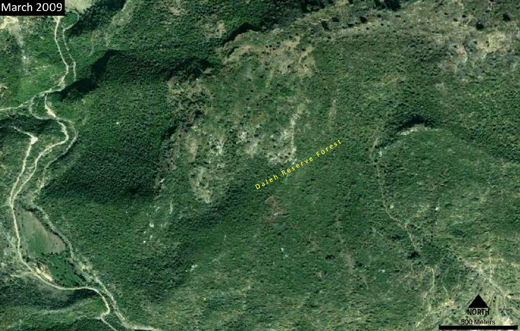
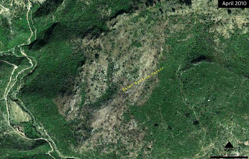
Forest Fire - Daleh Reserve Forest