
Map of the Four Wetlands Complexes in Pakistan 1- North-west Alpine Wetlands Complex |
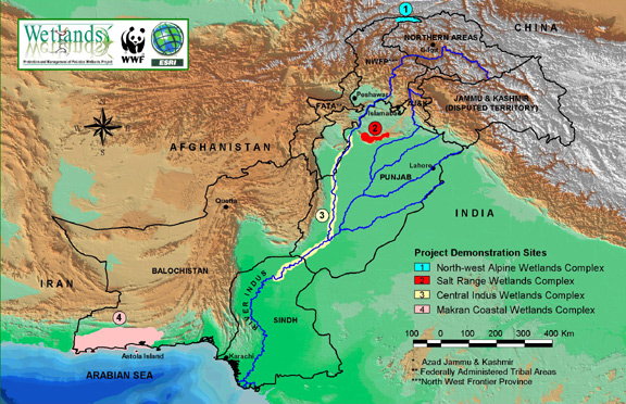 |
Click on the map for an enlarged view. |
|
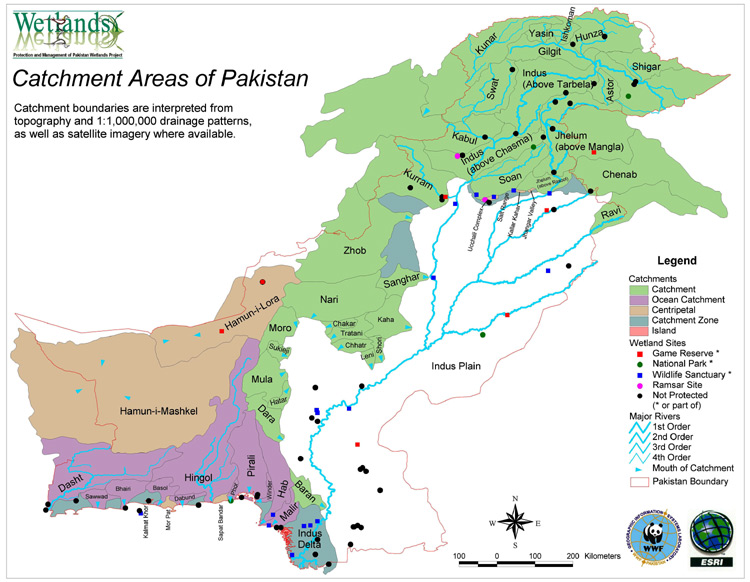
Map Showing Catchment Areas of Pakistan |
|
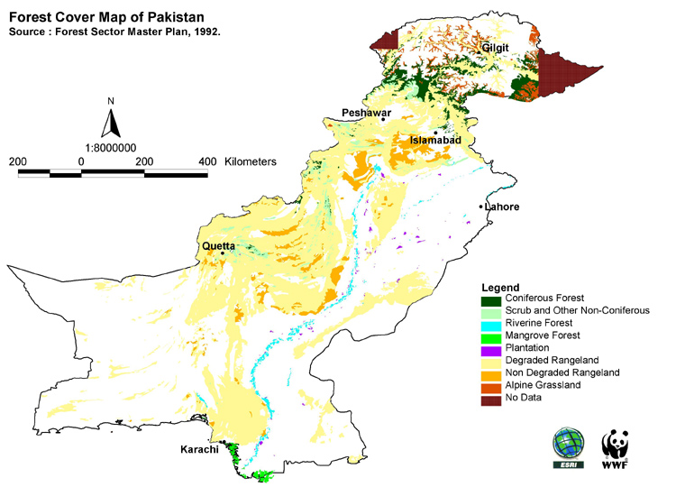
Forest Cover Map of Pakistan Click on the map for an enlarged view. |
|